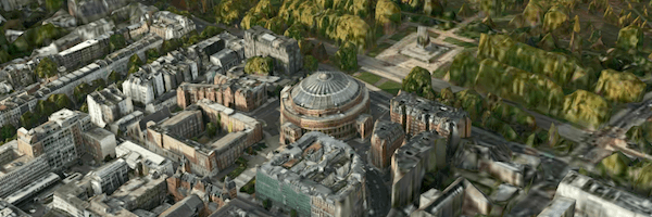
Hands up anyone who’s used Google Maps? Yep, so that’s pretty much everyone, I imagine. (If you did actually put your hand up, you can consider me amused.) Anyone used Nokia Maps? No? Well in case you’ve not seen it the folks over at Nokia have launched a WebGL view of the Earth, and I have to say it’s really rather nice.
There are fully textured 3D buildings, trees and monuments so you get a great view of the cities and towns when you zoom in. You can spin around, change the camera angle, pan and scan; all the things you’ve come to know and love. I’d say the only tricky thing is to find a specific location on the planet.
I can only imagine the amount of data that is being streamed over to the browser, whether that’s building geometry or textures, but I’m sure it’s a pretty mind bogglingly large data set!
Interestingly, Google recently updated their maps in a similar fashion. That’s worth a look over as well.

